


WEST Voting District, Effingham County, Illinois
About
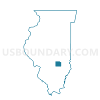
Outline

Summary
| Unique Area Identifier | 570832 |
| Name | WEST Voting District |
| County | Effingham County |
| State | Illinois |
| Area (square miles) | 36.95 |
| Land Area (square miles) | 36.91 |
| Water Area (square miles) | 0.04 |
| % of Land Area | 99.90 |
| % of Water Area | 0.10 |
| Latitude of the Internal Point | 38.94998450 |
| Longtitude of the Internal Point | -88.75672210 |
Maps


Graphs
Select a template below for downloading or customizing gragh for WEST Voting District, Effingham County, Illinois


Neighbors
Neighoring Voting District (by Name) Neighboring Voting District on the Map
- AVENA 2 Voting District, Fayette County, IL
- JACKSON Voting District, Effingham County, IL
- LA CLEDE 1 Voting District, Fayette County, IL
- LA CLEDE 2 Voting District, Fayette County, IL
- LARKINSBURG II Voting District, Clay County, IL
- LONE GROVE 1 Voting District, Fayette County, IL
- MASON 2 Voting District, Effingham County, IL
- MOUND 1 Voting District, Effingham County, IL
- MOUND 2 Voting District, Effingham County, IL
- WHEATLAND 1 Voting District, Fayette County, IL
Top 10 Neighboring County Subdivision (by Population) Neighboring County Subdivision on the Map
- Mound township, Effingham County, IL (3,648)
- Avena township, Fayette County, IL (2,010)
- Mason township, Effingham County, IL (1,364)
- Jackson township, Effingham County, IL (1,215)
- La Clede township, Fayette County, IL (909)
- Lone Grove township, Fayette County, IL (656)
- Larkinsburg township, Clay County, IL (644)
- West township, Effingham County, IL (467)
- Wheatland township, Fayette County, IL (467)
Top 10 Neighboring Unified School District (by Population) Neighboring Unified School District on the Map
- Effingham Community Unit School District 40, IL (20,287)
- Altamont Community Unit School District 10, IL (4,922)
- South Central Community Unit School District 401, IL (4,443)
- St. Elmo Community Unit School District 202, IL (2,727)
Top 10 Neighboring State Legislative District Lower Chamber (by Population) Neighboring State Legislative District Lower Chamber on the Map
Top 10 Neighboring State Legislative District Upper Chamber (by Population) Neighboring State Legislative District Upper Chamber on the Map
Top 10 Neighboring 111th Congressional District (by Population) Neighboring 111th Congressional District on the Map
Top 10 Neighboring Census Tract (by Population) Neighboring Census Tract on the Map
- Census Tract 9503, Effingham County, IL (4,210)
- Census Tract 9504, Effingham County, IL (3,867)
- Census Tract 9511, Fayette County, IL (2,931)
- Census Tract 9719, Clay County, IL (2,517)